|


| |
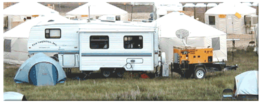
GIS Incident Mapping
Our GIS Unit has the
following equipment:
 |
2 high-speed
(1.7GHZ) Pentium 4 computer work stations (CD-Burner, DVD, Zip
Drive, 40 G Hard Drive, 17” Monitors) running MS Windows 2000
|
|
2 additional
networked work stations for use by incident personnel, such as the
Situation Unit and Fire Behavior Analyst
|
|
1 Plotter (HP
1055CM) – 36” print capability
|
|
1 Printer, color
(HP 1220CM) – 11” X 17”
|
|
1 Printer, laser
(HP 1200 CXI)
|
|
1 Scanner (HP
7400C)
|
|
Modems for each
computer
|
|
4 phone line
capability
|
|
Fax-copier
|
|
Garmin GPS Map 76
units
|
|
Digitizer
|
|
Digital Camera
|
|
Internet Access
– Both hardwire and two way high speed satellite.
|
|
Battery back-up
power supplies (UPS) for all computers and the plotter
|
|
24gb DAT Tape
Drive
|
|
Dedicated Power
Generator (15KW minimum), trailer mounted
|
|
Air conditioner
and heater.
|
|
160 square feet
of work space with 5½ of headroom.
|
We have state of the
art software loaded on our computer workstations:
|
|
Spatial Analyst
|
|
|
3D Analyst
|
|
|
ArcGIS 8.1 (ArcInfo)
with extensions
|
-
Spatial Analyst
-
3D Analyst
|
|
ArcView (3.2 and
8.1)
|
|
|
Network Analyst
|
|
|
Arc Press
|
|
|
Ventura Fire
Tools ArcView Extensions
|
|
|
Ozi Explorer GPS
Software
|
|
|
Farsite
|
|
|
I Suite Software
|
|
|
DeLorme Topo USA
|
|
|
Adobe Acrobat (PDF
ICS Forms)
|
|
|
Corel WordPerfect
(ICS Forms)
|
|
|
Microsoft Office
XP Professional (Word ICS Forms)
|
|
|
Paint Shop Pro
|
|
|
Norton Anti-virus
software
|
The GIS Unit arrives
with replacement cartridges for the printers, and plotter, a minimum of
4 rolls of paper for the plotter, a roll of clear film, a case of 8½ X
11 paper, 2 boxes of 11 X 17 paper.
We will have the
ability to produce the following as defined by the NRCG Geospatial Task
Group:
Situation Unit Map
A
situation map is a large map in size, fine scale (1:24K scale) of local
detail containing the most up-to-date record of the incident situation.
The base is generally comprised of USGS 7.5 minute Quads. This is a
work-in-progress map, continually updated, and designed to be printed
large (3’ X 5’). It remains in the Situation Unit, and is used for
preparing incident action planning maps and planning maps.
The map will contain
a legend with ICS symbology and a Mylar overlay to record heavily
detailed, current operations information, including access, roads, land
management activities, fire perimeter, Branches, Divisions, Drop Points,
Helispots, Safety Zones, hot spots, controlled and uncontrolled line,
etc. Much of this operational information is provided directly by field
observers.
Planning Map
The planning map is
usually a large map in size, and fine scale (1:24K) of local detail and
is used to facilitate discussion with managers at planning meetings and
briefings. Often custom made, this map can be comprised of USGS 7.5
minute Quads, a GIS map, or a sketch map. It will have key topographic
features, a legend, ICS symbology, access, fire perimeter, and general
operations information (Branches, Divisions, Drop Points, Helispots,
controlled and uncontrolled line, etc).
Incident Action Plan (IAP) Map
The IAP map(s)
display current incident information to be included with the IAP for
wide distribution. The IAP map is a snapshot in time, published daily
for each shift for use in the field. It’s printed as an 11”x17”
map or for larger fires, as a series maps. If several 11”x17” maps
are required, an index map may also be included.
The base is generally
comprised of USGS 7.5 minute Digital Raster Graphic Quads, 1:24K, or a
smaller scale up to 1:100,000 if key features and 200 foot or 100 meter
contours can be obtained. The IAP map(s) also includes a legend with ICS
symbology, access, fire perimeter, and specific operations information
(Branches, Divisions, Drop Points, Helispots, Safety Zones, controlled
and uncontrolled line, etc). As a field map, latitude and longitude grid
ticks are included for people utilizing GPS units.
Traffic Map
The traffic map
generally is a more broad scale map (1:63,360 to 1:250K) that shows
Incident Command Post (ICP), Incident Base, and Camps and routes to and
within the incident for operations and other personnel. The traffic map
may show any roads restrictions, preferred travel routes, bridge
limitations, fuel tank locations, hot spots, and generally finer detail
then you would see in a vicinity map (see below).
Vicinity Map
The vicinity map is
also a broad scale map (1:100,000 and up) that shows access to the
Incident Command Post and facilities, local ranger station, BLM field
office, Dispatch Centers or Staging Areas along main travel routes from
a known reference point, such as a city or an airport. A vicinity map
generally includes the ICP and incident location, but does not include
detailed incident information. It is usually printed on 8.5”x11”
paper, easily made distributable by hand or fax. The traffic map (see
above) may serve as a vicinity map if main travel routes and the
reference points are within the map area.
Fire Progression Map
The fire progression
map is a GIS map that displays changes in the daily fire perimeters. The
primary purpose of this map is a visual display of the fire movement
over time; it does not include much detailed information. Usually a fire
behavior analyst or the situation unit will request or maintain a fire
progression map.
We have the
capability to produce these additional maps based on data availability:
Topography Map
A topography map is
produced using either hill shade or 3D, and provides an overview of the
slope and aspect of the local terrain for incident ground and air
resources.
Fire History Map
This map shows the
fire history of the local area and can be modified to show particular
time periods, for example, areas that have burned during the past 30
years. This map is directly related to the vegetation map in that it may
show potential changes in fuel loadings.
Vegetation and/or Fuels Map
A map used by the
fire behavior analyst to help in predicting the fire behavior and for
developing suppression strategies. Conversion from vegetation to fuel
types will require input by the assigned fire behavior analyst or a
fuels specialist.
Farsite Maps
Farsite
modeling software provides several outputs which the fire behavior
analyst might want to display using the GIS software, including flame
length, fire intensity, rate of spread and heat per unit area.
Public Information Briefing Maps
The Incident
Information Officer typically uses these maps during public meetings and
briefings of the public.
Burned Area Emergency Rehabilitation (BAER) Maps
BAER teams require
maps to plan the rehabilitation efforts on fire incidents.
Availability
Fire Logistics, Inc.
resources are available 24 hours a day, 7 days a week through Helena
Interagency Dispatch Center.
Mobilization
Upon receipt of a
resource order for our GIS Mapping Support unit, we will be enroute to
the incident in:
|
In Region – 6
hours
|
|
Out of Region –
12 hours
|
Mobilization Costs
– None, all associated costs are detailed in the Emergency Equipment
Rental Agreement.
Demobilization
For scheduling and
finalizing work in progress we require notice to demobilize from the
incident as follows:
|
In Region – 24
hours
|
|
Out of Region –
48 hours
|
For
more information contact:
Bruce Suenram
Fire Logistics, Inc.
PO Box 2164
Montana City, MT 59634
406-449-9761
406-449-9768 Fax
bsuenram@firelogistics.com
|
|